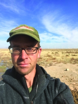
Senior Geologist, Groundwater Group
Utah Geological Survey
Bio:
Stefan Kirby is a licensed Professional Geologist working with the Groundwater and Paleontology group of the Utah Geological Survey. He is currently a Senior Geologist with active projects that include state funded hydrogeologic framework and water budget studies of groundwater basins, and federally funded projects focused on assessment of strategic and critical metals in industrial geothermal, and oil and gas produced waters. His completed and published work has included contributions to various geothermal projects, basin scale groundwater studies and water budgets, local and regional geologic mapping in the eastern Great Basin, establishment of regional scale groundwater level and groundwater quality monitoring networks, statistical analysis of basin scale groundwater chemistry, aquifer testing, and drilling and completion of various types of groundwater monitoring wells. Stefan Kirby received his MSc in geology from Utah State University in 2005. His graduate work focused on the evolution of the San Jacinto Fault Zone in the Salton Trough of southern California. Prior to this he worked as a geophysical field technician for the USGS at the Long Valley Volcano Observatory in California. He received a BSc. degree in geology with a minor in Physics from Colorado State University in 1999. He has also worked in environmental consulting.
Title: Mapping Groundwater Quality and Chemistry Adjacent to Great Salt Lake, Utah
Thursday, May 10th, 2:10 PM
Abstract: Groundwater chemistry influences the ecology of wetlands and groundwater dependent ecosystems in areas near Great Salt Lake (GSL). The chemical character and salinity of the groundwater system near GSL also control water usage for a variety of industrial, agricultural, and domestic sources and likely play an important role in the total salt budget of GSL. Despite this, previous work has not focused specifically on groundwater quality and chemistry surrounding the entire GSL. The goal of this project is to characterize groundwater and its potential input to GSL wetlands, by compiling existing chemistry data and collecting new samples in areas that immediately adjoin GSL. These data (including major ion chemistry, stable isotope composition, and site location) were combined into a geodatabase to create GIS-based maps of groundwater quality and chemistry. We compared the data with existing wetland water quality data, available from the Utah Geological Survey, Utah Department of Environmental Quality, and other organizations. This work is the first systematic basin-wide assessment of groundwater chemistry in areas near the lake that potentially feed the lake system, and the data can form a basis for future work to better delineate the interplay of groundwater and surface water supplying important wetlands adjoining GSL. The data may also lend insight into salinity contributions to GSL from groundwater.

